Day 4: Tuolumne Meadows -> Parker & Koip Passes -> Algers Lakes
/12 Miles / Ascent +3,196 feet / Descent -2,273 feet

Looking back (north) towards Tuolumne just before reaching Parker Pass.
The first half of this day could not have been more different than the second. It might as well have been two completely different days - activity-wise and mentally.
Start. Stop. Wait.
Then...
Go! Go! Go!
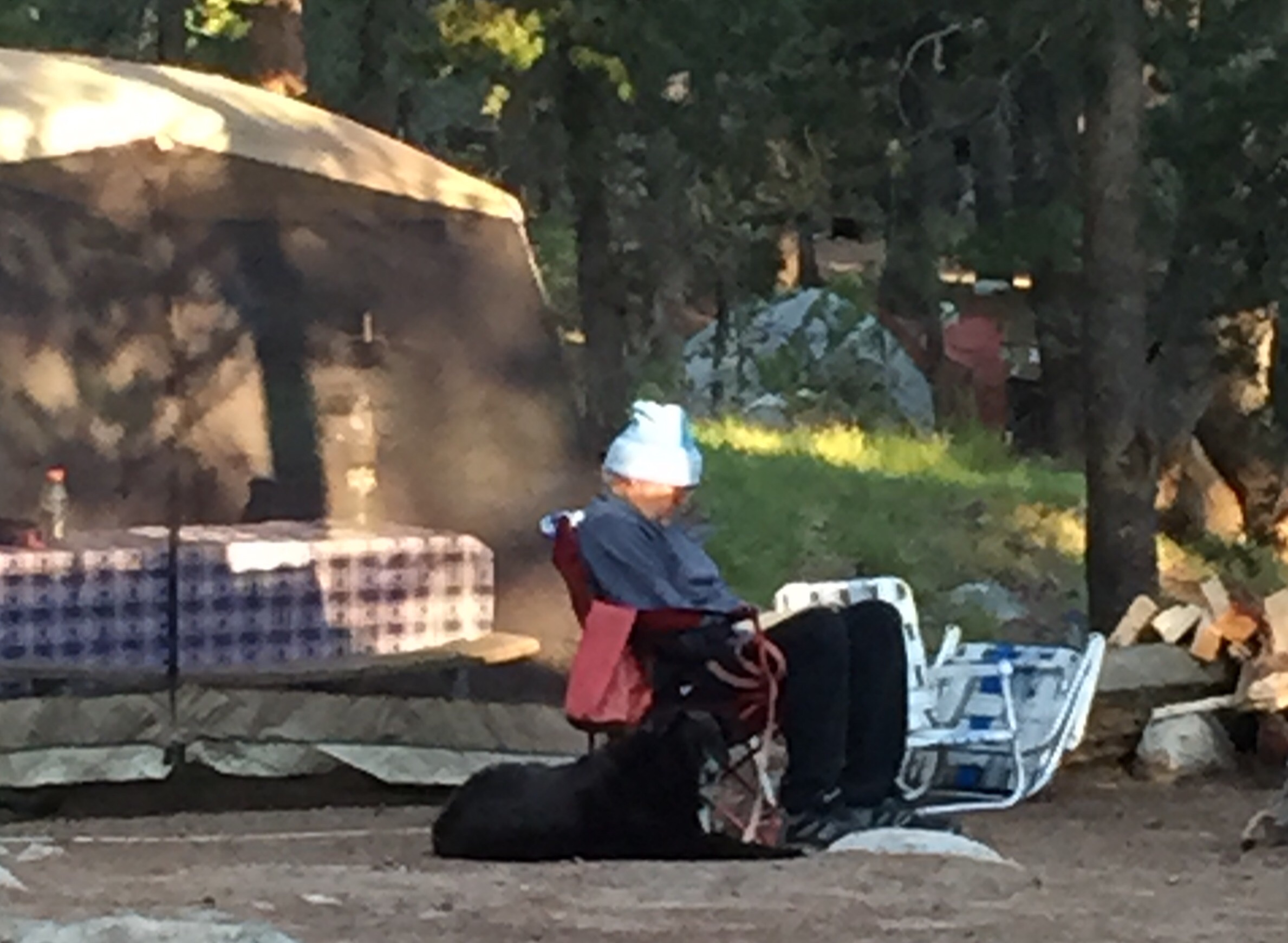
This old fella epitomized great American car camping: 6am, asleep in his camp chair, bundled in hat and sweatshirt, trusty dog waiting to be fed. We were soon to become quite cozy.
I slept like hell again and was thankful for the early sunrise to get me out of sleep limbo. We had a full plate today and I had a logistical detour to accomplish earlier than the others. On my way to the car campground toilets I passed someone's grandpa snoozing in a chair next to his tent pavilion. I must have woken him up because he ended up in the stall next to me, smelling of stale cigars. He started off and continued to make a lot of noise, as if he were pushing a broken down truck up a steep hill. Guessing from the decibel and duration, it must have been a big hill, or a heavy truck. I couldn't help guffawing in response to his outbursts, and tried (unsuccessfully) to cover it up by pretending to cough. I was so looking forward that morning to using a flushing toilet, but this was not how I envisioned it. It really sounded like he was having a hard time in there. I almost felt like asking him if he needed a hand, but that would have been inappropriate.
The plan was to pick up our food resupply at the post office when it opened at 8am and then jump on the shuttle bus to the Mono/Parker Pass trail head 6 miles down the road. Since the typical Donohue exit quota was fully booked by April (when I started planning) I determined this was our best alternate route south out of Yosemite. I had to pick up our second group permit at the Wilderness Center which was about a mile away, and I had to get there early to avoid the inevitable line during peak season for walk-up permits.

Lambert Dome reveals itself on my solo side trip to the Tuolumne Wilderness Center.
The JMT is renown for not crossing a single road in its 220 miles. Just about every other long form trail does at some point, but not this one. Even with our alternate Yosemite exit I managed to keep us from having to cross a road, keeping to the spirit of this trail. I just loved what that conveyed - nary a road crossing in 220 miles: a pure wilderness experience!
Walking over a bridge on my way to the wilderness center I wanted a look at the trout some anglers were casting for so I crossed the road to find out.
Damn it.
I crossed. The road.
It didn't register at first while I was eyeballing the smallish trout feeding below. Then it hit me. In fact I felt a big wet *thwapp* across my face as John Muir's foggy ghost slapped me before floating away to smack other other boobs.

I crossed the road. Not worth it. still, I saw some fish. Meh.

With a trail sign like this I wasn't going to walk on the road - I was walking on both the JMT and the PCT!
I found a trail running parallel to the road and decided to atone to John Muir by following it instead of the easier road walk. It did afford me my closest encounter ever with a buck....I guess that was J. Muir's way of letting me know he and I were good again.
I was second in line for reserved permit pickups when the center opened at 8am. After answering a battery of backcountry 'Leave No Trace' qualifiers, this sweet but befuddled ranger printed out my permit. In my haste I signed it without reading it over and dashed back the mile to the post office (in the interest of time I did take the road but did NOT cross it). Stuffing that permit into my hiker wallet without reading it would come to haunt Gus and I twelve days later....

One long tent serves as the Store, Post Ofc & Grocery & Grill. Some hikers enjoying some repacking.
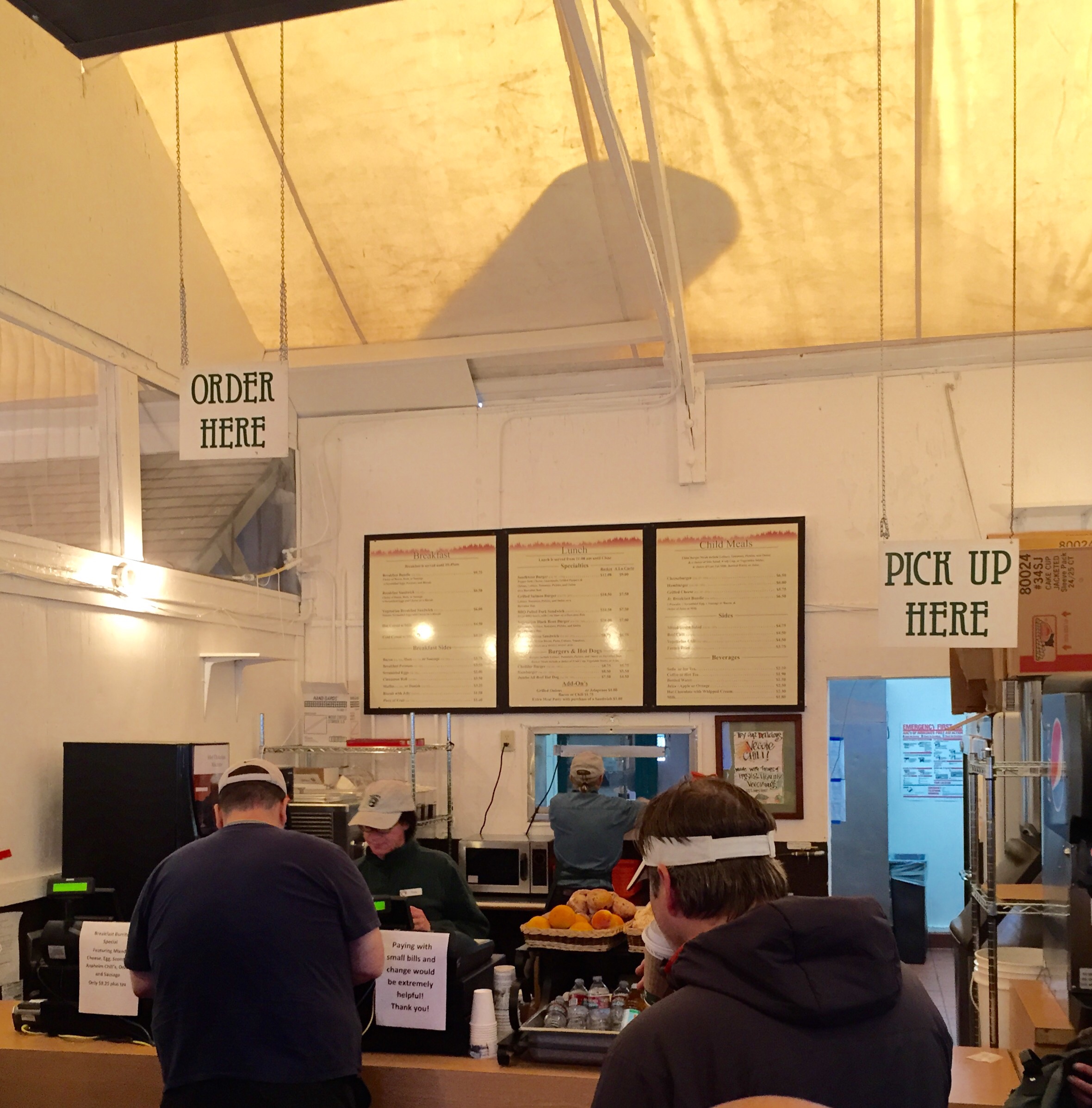
The Grill: spare but sufficient.
When I arrive at the post office at 8:30am Jason tells me that it won't actually open until 9am. Our shuttle was at 9:15 so that gave us almost no time to collect our buckets and perform a resupply. I was starved so I went to the grill and ordered pancakes. Whole wheat and drenched in butter, I had Jason circling me with his fork after he finished off his Hikers Scramble. I should have expected it - we've been on enough trips together and Jason is always vulturing my pancakes. These tasted so good that I wanted him to know what he missed. He took a bite and then sent Katherine in to get them an order.
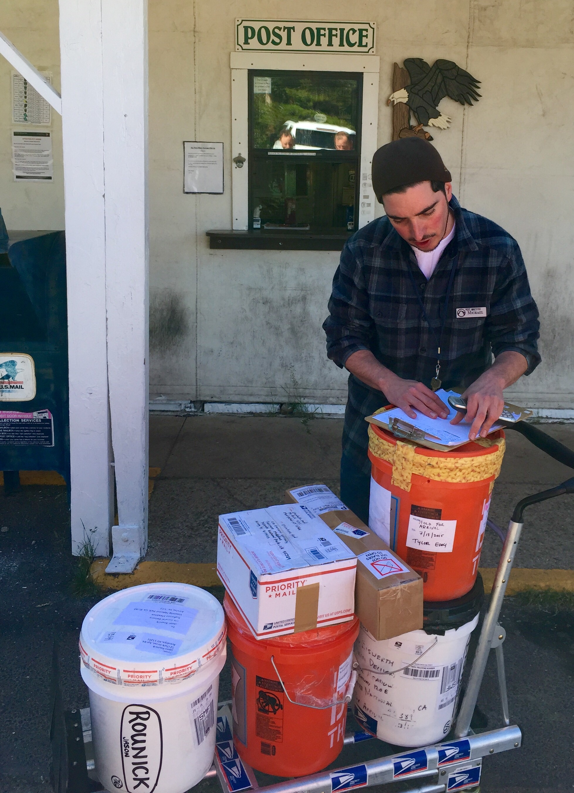
His name tag reads "Michael, Mail Maestro" (really - see for yourself). It took 3 hours to "Maestro" our buckets, seen here.
The post office opens and this tired, cranky kid emerges announcing they will be releasing the buckets in batches every hour based on a signup sheet. We could see our buckets lined up on a shelf behind him, but no-can-do. He explains that it's due to x, y and z, plus he was up all night driving medicine to a hiker that needed a special delivery, and his goldfish died earlier in the week, and he couldn't wait for the summer to end so that he could finish up his senior year at Boulder and smoke a lot of medical marijuana and yadda yadda yadda.
We put our names on the list and did errands. Lindsay's air mattress had a major leak from day one and she was freezing every night so she went to the sports shop and bought a replacement.
Our buckets didn't come out until 10:30am and we scrambled to figure out what we wanted to keep and what to dump based on our prior eating habits and the effort and time on trails to come. There was a lot of shuffling and we still all ended up bringing more food than we needed.
You're first resupply is usually a stressful process. A month before the trip you prescribe yourself an amount of food, buy it, sort and pack it and send it ahead two weeks before even taking your first step on the trail. And you're all questions and no hard answers - a bit of science and a lot of guesswork. Portion sizes? Carb/fat/protein ratio? Enough variety to motivate you to eat when altitude has sapped your appetite? Will you be bored of eating oatmeal for 17 days straight? (YES)

Our well fed but exhausted group in the midst of Resupply pandemonium outside the Post Ofc...
You're not really going to be sure how much you'll eat until you're there. I can say that all of us had a hard time eating through each day's supply. Due to a combination of altitude and the early stages of the hike, you haven't built up your appetite. A modicum of online research will tell you this, but people are wary, so you end up sending ahead more food than you can actually, or really want to eat. So you end up giving a bunch away when you get to your first (second and third) resupply. While there was a little horse trading (Tyler gave me a mashed potato dinner, I gave away some candy bars to Gus), most of us were setting aside an average of 20% of our food for the hikers' bucket. Each resupply point has one of these: a big container that everybody's extra food gets donated/dumped into. Other hikers are free to rummage through it and take whatever they want. The only rule is nothing half eaten or used can go into the bucket. Hikers low on supplies (or $) usually gather around the bucket and can score significant bounty. Just about anything from food to toilet paper and all sorts of utilities and supplies that others found unnecessary or just too heavy get left behind. You see it all.

I can't even look at this food now a couple of months later - I'm still sick of it.
Based on my research I concluded that I would need daily:
*Oatmeal breakfast (dehydrated)
*Morning snack (pickings of trail mix/4 Nutter Butters/jerky/Kind bar/Almond Joy/Snickers)
*Lunch: a tortilla with peanut butter, some sausage and a cheese stick for lunch (I quickly abandoned the idea of eating these like an antipasti platter and rolled them up á la Tyler's High Sierra Pizza as it saved time and tasted the same)
*Afternoon snack same as morning snack
*Dinner (dehydrated)
I rarely ate all of my snacks and usually had a candy bar/Kind bar, some trail mix and some jerky left. I rolled these over to the next day's snack and never ended up eating through my snack supply. I distinctly remember joyfully heaving a bag of trail mix into a dumpster at Whitney Portal at the end of the trip (never offer me mixed nuts and raisins again).
Since it took us so long to get our buckets and sort through our resupply we missed the shuttle bus and decided to hitchhike to the Mono/Parker Pass trail head 6 miles down the road.
Lindsay and the Deutsch RV. The short hitchhike ride in it made me want to go RV'ing out west.
We broke into three groups of two to maximize our chances of getting picked up. There is practically zero cell service so the plan was for me to go first as only I knew where the trail head was located. Then I was to stand conspicuously on the side of the road to signal those following where to stop. We decided to have Lindsay go with me instead of Gus, since mixed couples are less threatening than two guys. Lindsay walked right up to an RV about to pull onto the highway and asked them if they could give us a lift. The couple in the cab shrugged and replied "Ya!". It couldn't have been easier.
Turns out it was a German family with two young daughters doing a tour from San Francisco to the Grand Canyon. Lindsay was great at chatting them up while I kept my eyes peeled on the road ahead and the GPS to ensure that we didn't miss the trailhead. The family was super nice and we had a great chat with them and 10 minutes later the trail head pull-off came into view. Waving our goodbyes we perched ourselves on the side of the road and waited. Gus and Tyler got dropped off next but said Jason and Katherine left way before them. Since we couldn't call them I got worried they missed seeing us and were way down the road. A full 1/2 hour later they showed up with a grinning couple that apologized for making what they thought was going to be short stop for a permit at the Wilderness Center.
Finally we could start our hike that would cover two passes, Parker at 11,000' and Koip at 12,000'. It was already noon and we had to make up for a morning lost.
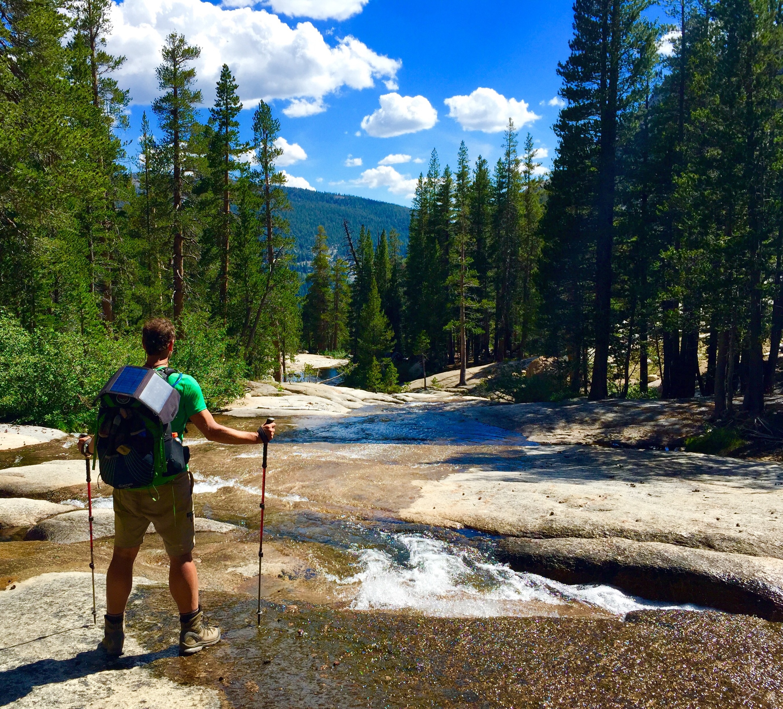
After a hectic morning of resupply and hitchhiking we finally hit the trail.
Doing the JMT southbound (SOBO) the trail runs roughly west to east until Tuolumne. From there it heads predominantly south the remainder of the trek. Today we were headed south with a Yosemite Park exit at Parker Pass, taking us into the Ansel Adams Wilderness.
Looking back on the trip I realized that I never really gave us an easy or "lay-up" day. Every day was fairly difficult for different reasons. The last two days we averaged 16miles/day (and over 3,000' of elevation gain) for just our second and third days on the trail (most newbie hikers barely broach 12 miles).
While today was going to be *only* 12 miles, we were starting at high elevation, 9,500', and going very high, 12,000'. There are certain elevations that are known to play havoc with the human body if adequate acclimatization is not observed. And there are people that cannot handle certain elevations despite attempts to acclimate. Either way, going from 4,500' three days earlier to 12,000' today with six people was going be like playing roulette . We prayed not to hit black.
Mr. Wang & The Goose.

Our man Tyler looks a lot better when he doesn't have a Sierra Pizza in his lap.
The first part of the hike was through some pleasantly rolling forest. Then we came to the start of the first of that day's two climbs. Looking back, this one was a more of a speed bump compared to what Koip would throw at us later.
Jason raced up (per usual). Gus explained his technique for "aiming" for the shady spots so I decided to ghost him. At this point Gus' blisters were probably heating up so any effort to mitigate other discomforts could save precious physical and mental energy. Gus always kept a steady pace and once his blisters healed later in the trip he proved to be an exceptionally strong and consistent hiker, besting me on many climbs.
The first climb ends and the trail evens out.
Out of the forest and almost above the tree line - @ 10,000' here. Tyler watches as Jason unpacks/repacks Kat's Pack. They did this a lot.
Granite gives way to an ochre shale.
A macro shot of these tiny purple flowers.
Looking back north, from whence we came in Yosemite, on the trail south to Parker pass.
The beginning of the approach to Parker Pass.
The meadow seemed to never end, but was a welcome gentle slope.
Gus catches me pulling up the rear while heading south across the meadow.
Parker Pass is the flat low point just right of the middle horizon.
The approach from the north, heading south to Parker Pass. This was our SOBO JMT alternate exit out of Yosemite as Donohue quota was full.
Inching toward Parker Pass. It initially looked like a quick lope over a meadow but turned out to take much longer.

These bright purple flowers existed in a rather hostile environment.
While Cathedral Pass the day before was a bitch, I totally missed calling it out to the group as I was too hot, dry and delirious to register that we were crossing it. It was also just below the tree line and I guess I expected it to look more 'open' like other passes I saw online. I did notice an older hiker taking pictures off the side of the trail at a high point with nice views but I blew past her in an effort to make it to the pass. It later registered that was Cathedral Pass...
Since we missed our first pass completely, we were excited to bag Parker Pass. Yet the feeling as I neared the mark on the GPS was...anticlimactic. The grade leading to the pass was so gentle...and pleasant...that I kept having to look at the map wondering if we weren't meant to be humping over one of the dramatic peaks to our right or left. Thank god for the sign we ran into that read "Parker Pass".
Jason straddles Parker Pass at 11,000'. Gus straddles something I'm-not-sure-what.
Deep blue, stark white and ochre, striking, yet sublime.

We needed a snack break although it was windy and we were quite exposed. As we were all layering up we encountered a hiker, dressed exclusively in white like some Sierra cult member, hiking towards us from the south. He was in his 50's, thin and fit, and was outfitted in an ultralight loadout. Turns out he was doing a nine day solo trek on part of the Sierra High Route which is part-trail, part-cross country, and mostly above the tree line, hence the white outfit. We chatted for a bit and then he moved on and so did we. The only fore-warning he gave us was that his climb down Koip was "interesting".
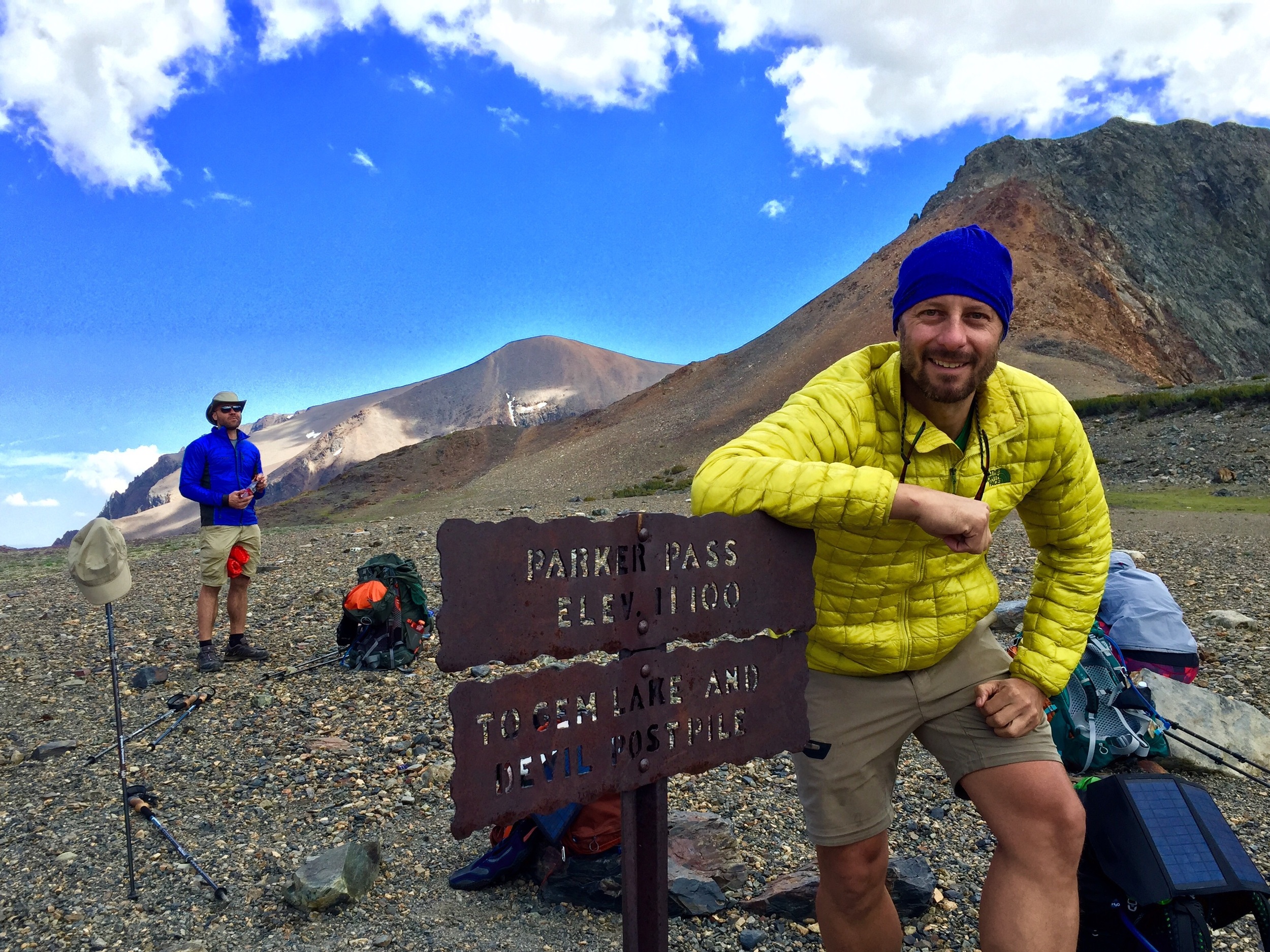
Obligatory pass pic - expedition pose.
I coach Gus on executing "Expedition Pose".
Heading over Parker Pass and on towards Koip (in the middle at 12 o'clock).
Just made it over Parker Pass, headed to Koip. Parker was so mild, Koip ended up being steep, exposed, brutal at 12,000'.

Gus at 11,000'. He looks great at sea level too, ladies.
On the trail between Parker Pass and Koip Pass, Ansel Adams Wilderness

Tyler, Lindsay and Gus on one of the many stream fordings between Parker and Koip passes.
The valley at 11,000' that we crossed on our way to conquer Koip Pass (at 1 o'clock). Photo by Gus
Hiking in talus fields by emerald tarns, Ansel Adams Wilderness.
Just before the start up Koip Pass trail.
I pushed on ahead of the others to verify we were on the trail, which was unmarked and therefore hard to follow in the talus (vs dirt). The climb started up the stream run-off from the snowfield above and then soon shifted onto the dry and steep talus mountain to the south.
The rolling trail to Koip wasn't more than 1.5 miles but was also exposed, windy and talus-strewn. The sun eventually revealed itself and with that our moods brightened. As we pulled up to the start of Koip we found ourselves on the eastern edge of the Sierras - literally. The mountains seemed to end with a sharp drop through the notch pictured above and we were treated to views of the Nevada desert to the east.
Hopalong Kat all smiles before the climb up Koip. She was about the only one smiling when we reached the top.

Mr. Wang. So stoic. VIEWS WEST TO THE LOW NEVADA DESERT STAND IN STARK CONTRAST TO OUR HIGH PERCH.

Jason and Katherine adjusting packs before the climb.
Before heading up Koip I make a short detour to a snowfield in to make sure that I can say I "walked in snow" during the trek in a (thankfully) low-snowfall year in the Sierras.

START OF THE STEEP KOIP PASS CLIMB. Gus, Lindsay & Tyler
Lindsay, Tyler and Gus.
A series of interminable switchbacks on a 2' wide trail of shifty talus marked the next 45 minutes of protracted climbing. The slope was steep and sheer and there was nothing to break your fall if you took a hard tumble. For someone with vertigo this is a challenging environment. I have vertigo and the higher up we climbed, the worse it got.

The trail starts up to Koip Pass - it's that faint line running diagonally left to right.
If there is a shelf a reasonable distance below me on a climb like this my vertigo isn't as evident. Psychologically I start to wither when there is nothing there to stop my fall and for some reason this affects my balance too. Add to this the fact that I was at the highest altitude I have ever been and not properly acclimated, and it was was recipe for disaster. I couldn't look down the slope, up the slope, ahead up the trail, or turn my head much without getting fairly dizzy. I had taken my jacket off at the start of the climb and it was blowing pretty hard, but I didn't have it in me to remove my pack and put my jacket on. That was a series of movements that under normal circumstances would have been routine, but here could doom me. The only place I could safely stare was a cone of vision that extended 10' ahead on the 'ground' of the skinny trail ahead.

Katherine, Lindsay, Gus & Tyler.
View of our climb up the north side of Koip Pass trail on our way headed south to link up with the John Muir Trail.
Looking back, towards the top where the grade becomes gentler.
Just about hitting the top of Koip Pass while headed south. Jason's expression says it all about this long, exposed climb. Not easy even in the great weather we had.
Jason had hoofed up behind me so I immediately let him know how I felt. He was relatively fine so he agreed to guide me, letting me know what was coming up ahead, turns "Right turn switchback in 20 feet", etc. He basically "steered" me up Koip.
Meanwhile, further below, Gus was doing some "steering" of his own. Not long after initiating the climb, Tyler started to complain of being really tired and dizzy and announced he was going to sit down and rest on the steep talus trail. Sensing something wasn't quite right, Gus coached Tyler against trying to rest on the dangerously steep slope and continuing on. The couple times I tried to look down to check on the rest of the group (my vertigo made this hard), I did see Gus behind Tyler seemingly have a standing rest together.
Jason took this shot of me towards the top of the climb. I almost fell over. Nevada and the desert to the east behind me.
Flowers thrive while we wither.
It wasn't until they pulled up to the top behind us that we learned the extent of Tyler's symptoms. He appeared a pale green and there was an air of delirium about him. We made him take a Diamox, chug some water and lie down. Lindsay also admitted to moderate vertigo on the climb - 3 out of 6 of us aren't great odds....We all took a needed break.
Even Jason needed a break.
Serious shuteye. I placed the rock on Gus' hat to keep it from blowing away. As I said, i envied his hat...
I could hardly read the sign, but there we were: Koip Pass, 12,267'.
My Ambit2 showing Grade %, current altitude and the day's total ascent.
We were all ready to get down off the pass. Altitude issues and a howling wind drove us down the south side of Koip Pass Trail and its gentler grade made this a welcome descent. Our campsite destination could be viewed clearly below: Algers Lakes. It was about 5:30pm (remember we didn't hit the trail until noon) and clear and beautiful to the south. The views to Algers lakes and beyond were literally breathtaking. So was the altitude at 12,000' and we were all motivated to get into camp and take a load off.
Heading south down north face of Koip Pass (12,000'), towards our camp at Algers lakes, seen below. Altitude causes me to incorrectly identify this as Parker Pass.
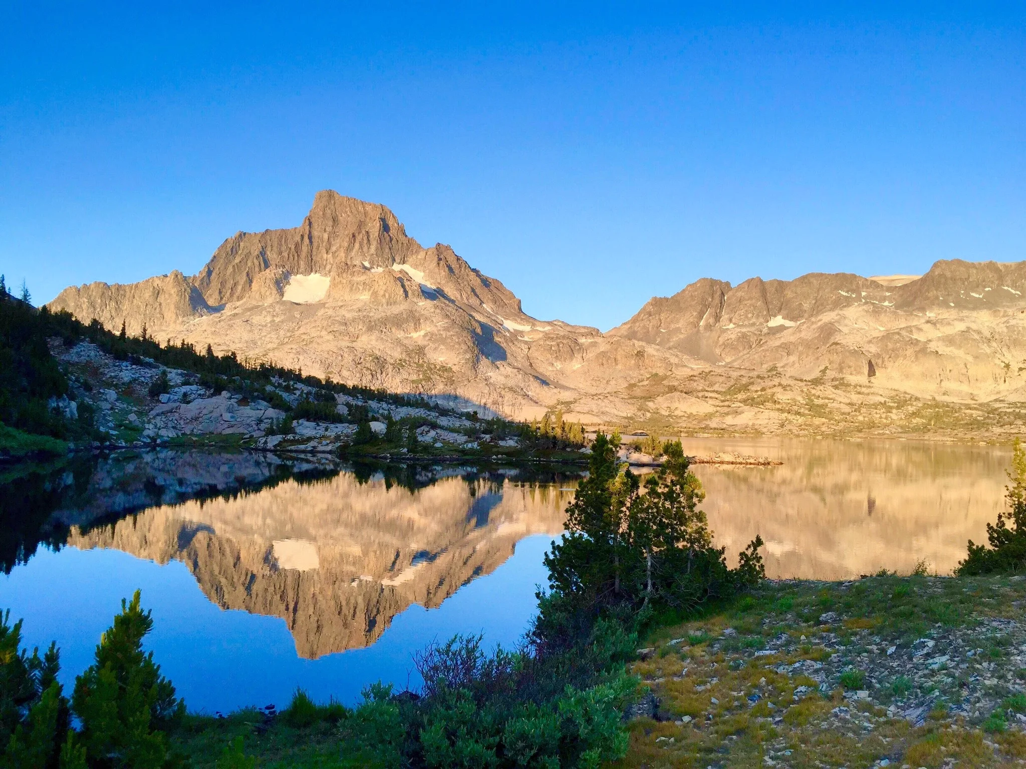
Algers Lakes, our destination for the evening.
Jason and I couldn't believe the view and had to document ourselves in it..
Katherine and Jason descending 1,000' on a more forgiving grade of talus.

Down, down through the talus fields.
We camped right close to where that isthmus almost splits Algers lake in two on the left shore.
I was worried about finding a suitable campsite (i.e. views and water access) before sundown so I literally ran a mile ahead attempting to pull a "Last of the Mohicans" shale-ski and a cross-country off-trail run. I was worried that I'd be talked into an inferior location by a justifiably ragged group. We were descending into a little bowl of a valley suspended at 11,000' and ringed by steep mountains that could block the the low evening sun soon if we weren't careful in picking our campsite. I felt that we needed as much sunlight as we could get to boost morale after a tough, long day.
Jason & Katherine always got their tent up first - which gave them more time to do laundry. A lot of laundry.
Campsite setup, racing the setting sun, after descending Koip Pass Trail after leaving Yosemite over Parker Pass on the way to the JMT.
I found myself about a mile ahead of the group when I found a suitable site: open views and fairly close (or so I thought) water. I watched a mile behind me as Kat and Jason scrambled around hilltops looking for me. I stood in the most open area I could find and waved my trekking popes in the air in a "Y" configuration trying to transmit a positive affirmation for campsite selection. They told me they couldn't see what I was doing and just decided to walk down the valley to meet me. It became clear that without functioning cellphones it was very difficult to keep tabs and communicate with each other when we got out of shouting range. I was mostly thrilled to be "offline" but limited intra-group communication was going to be an adjustment to be wary of in the future.
Lindsay watches again as Tyler confuses the fly with the tent body. Jason sets trekking poles up for his "Privacy Perimeter".
My tent - I obsessive-compulsively always went for the "perfect pitch" which just took too damn long (and was never perfect).
I chose the spot partly due to the two logs which made meal prep much more comfortable.
Our kitchens were always a mess, but so were we at the end of the day. Jason coming back from the long walk for water.
Comparing dinners. Kat had some "interesting" gluten-free ones. I didn't try them but her snacks were very tasty. Jason: always filtering or always washing.
Kat and Tyler put on smiles for the camera. Lindsay's expression says it all, though. Mac'n'cheese for her, every night.
Gus and I ate in our own dining area on a different log. Apparently there wasn't room on the nicer log.
Gus half-heartedly throws his fly on, barely staking out the guylines. We were beat.
It was a majestic campsite - an emerald valley at 11,000' close by a glacier-fed tarn, ringed by snow tinged peaks. And down in this valley, in the lee of the mountain, there was no wind. What I vividly recall as I write this now was that there was absolutely no noise - the valley was pin-drop quiet. And without another soul in sight it was the quintessence of solitude.
Tomorrow was going to be a "short" day (~9 miles), which was good news for anyone with any issues: knee twinges, shoulder cramps, searing blisters.
The bad news is that "swollen and throbbing" & "fully ripened and festering" can make a milk run a nightmare.
Sierra Mapper's topo of our route.
Sierra Mapper's elevation profile of the day's trek.